Streams and Ponds

New Stream Steward Guide
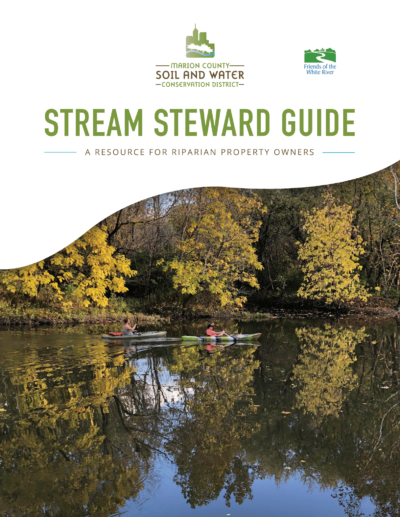
The Marion County SWCD, in partnership with Friends of the White River has created a new guide for landowners with land on streams or the river. This project was funded by Nina Pulliam Charitable Trust’s Partners of the White River initiative. Online and paper copies are available through the District.
View Stream Steward Guide
Live staking can be an inexpensive erosion control practice for streambanks. Penn State Extension has an excellent “How To” video on choosing and planting live stakes. Check it out HERE
What is a Watershed?
A watershed is the area of land where all of the water that is under it, or drains off of it, goes to the same place. A watershed carries water “shed” from the land after rain falls and snow melts. Drop by drop, water is channeled into soils, ground waters, ditches, creeks, and streams, making its way to larger rivers and eventually the sea.
“When we try to pick out anything by itself, we find it hitched to everything else in the universe” – John Muir
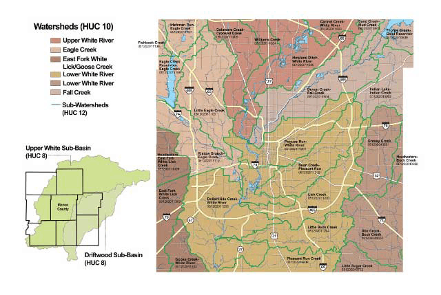
Watersheds of Marion County

Lower Fall Creek Management Plan Update
The Lower Fall Creek Watershed Management Plan was originally completed in 2009 and was recently updated and approved by US EPA and IDEM in April 2023. The district will apply this Fall for plan update implementation funding through IDEM ‘s 319 grant program authorized by Section 319 (h) of the federal Clean Water Act. Led by district staff, a project consultant from Christopher Burke Engineering, LLC and the ROW Fall Creek Waterway Committee, this update effort started in February 2020. The original 2009 plan needed updated since the watershed’s sub watershed delineations changed and new strategies were needed to reduce sediment, bacteria and nutrient loading in the watershed.
The approved plan update with exhibits is available on IDEM’s website on the link below:
Approved Lower Fall Creek Watershed Plan
Take a tour of the watershed and identify points of interest and areas of concern through the GIS Storymap below:
Help Improve Water Quality in Your Stream or Pond
To help you find ways to help improve water quality, we have developed a number of informational fact sheets to help you get the information you need to make wise decisions about your land.

How to Strengthen Our Waterways
Know No Stranger teamed up with Reconnecting Our Waterways (ROW) to present a lighthearted but educational story of the six Indianapolis waterways currently served by the ROW effort to strengthen the city’s waterways and the neighborhoods surrounding them.
Click HERE to watch!


